Polynesia’s earliest society has a rich history of caring for and sharing the territory they call home. Samoa, the name they gave their country, means “sacred soil,” which is how they feel about it.
American Samoa is a region of the United States that consists of ten volcanic islands (five of which are populated) and two coral atolls about 2,600 miles southwest of Oahu (one inhabited). That area became a national park thanks to a 1988 law passed by Congress.
The National Park Service has control over a stretch of rain forests, beach, and coral reef on three islets thanks to a lease signed by Samoan leaders in 1993. Samoans contribute to park maintenance and visitor services by operating a variety of businesses in nearby communities.
Five different types of rainforest ecosystems (lowland, montane, coast, ridge, and cloud) are all protected in the park, along with hundreds of plant species. There is no other rainforest of its kind in the United States. The rare flying fox, a fruit bat about the size of a barn owl, and other species of flora and wildlife can be observed by tourists.
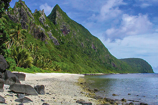
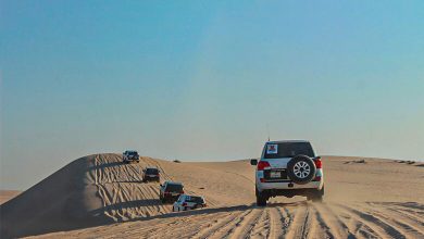
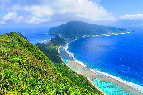
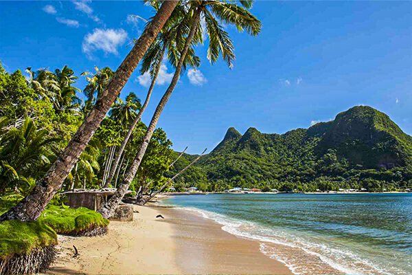
Tutuila, the biggest of the American Samoan islands, is characterized by steep volcanic hills that gaze out over Pago Pago Harbor’s azure seas. Very little of the area is flat, with the exception of a few small towns and the scenic drive that follows the edge of the bay and the stunning southern shoreline.
About 2,500 acres of land and about 1,200 acres of water make up the park’s area on the island’s northern side, atop this crumbled terrain that plunges sharply toward the sea.
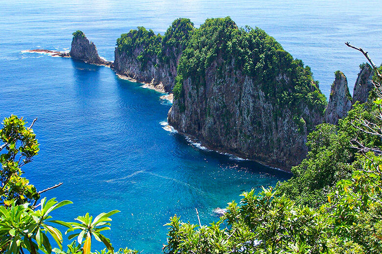
About 5,400 acres, including American Samoa’s highest summit Lata Mountain, are preserved as parkland on Ta’u, the easternmost island. Another 1,000 acres are protected nearby. The vista from the cloud forest to the rocky shore of the south is breathtaking. The small and isolated Ofu Island is home to arguably American Samoa’s most beautiful shoreline. The coral reef, which spans an area of about 350 acres, is the primary draw here.
American Samoa
The eastern portion of the Samoan island in the south-central Pacific Ocean is referred to as American Samoa, formally the Territory of American Samoa, an unincorporated possession of the United States. It is located about 2,600 kilometers northeast of New Zealand and 3,500 kilometers southwest of Honolulu in the United States.
All six Samoan islands located east of the 171° W longitude are included in the region. Samoa (formerly Western Samoa) is the Polynesian island west of the meridian and a self-governing nation that shares a border with Samoa. Tutuila, Tau, Olosega, Ofu, and Aunuu are the populated islands in American Samoa.
Rose Atoll is a coral atoll that is part of American Samoa but is deserted. Located about 280 miles (450 km) northwest of Tutuila, Swains Island is a physiographically distinct coral island that was officially incorporated into American Samoa in 1925. Pago Pago, located on Tutuila, is the city of American Samoa.
When compared to Hawaii in the 1950s, American Samoa stands as a pristine, natural location years ahead of the rest of the islands. It’s a natural setting, perfect for ecotourism’s slow and steady expansion. As it stands, there are fewer than 200 available motel rooms and only one eatery that is certain to be open on a Sunday.
How to get to the National Park of American Samoa
Twice weekly, you can catch a 5.5-hour trip from Honolulu to Pago Pago. To get there from California would take about 14 hours, with a 3- or 4-hour stopover in Hawaii. To reach the Sadie Thompson Hotel, Sadies by the Sea Facility, Pago Airport Inn, Tessarea Vaitogi Inn, Tradewinds, or Motu-o-Fiafiaga Motel from the airport, you can take a cab or hire a vehicle.
The park’s tourist center in Pago Pago is easily accessible by bus or vehicle from any of those lodgings. Ta’u, Ofu, and Olosega also offer lodging options. A trip to Ta’u takes about half an hour from Pago Pago, while tourists to Ofu Island are taken there by local fishermen. Parkland on Ta’u is about a half-hour walk from the airport, while on Ofu, it starts at the border of the runway.
When is the best time to visit the National Park of American Samoa?
Any time of the year is a good time to go to the National Park of American Samoa, really! Due to their location, 14 degrees south of the Equator, the islands experience humid and wet weather throughout the year. From June through September, the weather is slightly more bearable, with less humidity and less rain.
The wildlife and nature of the National Park of American Samoa
The islands’ mountainous areas are covered in lush rainforests teeming with towering ferns and trees. Coastal areas are home to a variety of plantations, including those that produce taro, cocoa, and other edible products.
The islands don’t have a lot of different kinds of animals, but they do have some interesting birds, like the tooth-billed dove. Animals found in this area include hogs, rodents, snakes, lizards, and flying foxes (a species of bat). Insects, both soaring and burrowing, can be found in great abundance on the islands.