


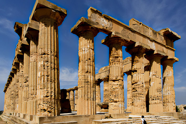
The most extensive archaeological site in Europe. Myth, folklore, history, culture: the Park of Selinunte is so much more. A treasure chest from millennia ago that is still alive and well right here. 270 hectares dedicated to one of the Mediterranean’s most thriving ancient civilizations.
A fascinating narrative that claims to be undiscovered, coveted by visitors as well as researchers and intellectuals from throughout the world.
About the park of Selinuntin
The city is located on two high regions joined by a short isthmus, between the Modione River (the old Selinus) in the west and the Cottone River in the east. The Acropolis is located in the southern section of the city, near the sea, and is built around two intersecting streets with several temples (A, B, C, D, O).
The metropolis on Mannuzza Hill to the north, deeper inland, included Hippodamian-style dwellings contemporaneous with the acropolis and two necropoleis (Galera-Bagliazzo and Manuzza).


North of the current settlement of Marinella, three temples (E, F, G) and a necropolis (Buffa) may be found in the east. The oldest remnants of Selinus are the Sanctuary of the Malophoros and the ancient necropolis (Manicalunga, Pipio, Timpone Nero). The city’s two ports were located at the confluence of the city’s two rivers.
Other significant ruins can be located on high ground across the rivers to the east and west of the city.
The current Archaeological Park, which encompasses around 270 hectares, may thus be split into the following sections:
- The Acropolis, with temples and fortresses, is located in the center.
- Gaggera Hill in the west, with Malophoros’ sanctuary
- Mannuzza Hill in the north, with its historic dwellings
- East Hill on the east, with more temples
- The Necropolis is a cemetery.
The Acropolis
The Acropolis is built on a limestone massif with a cliff wall that drops into the sea in the south and narrows to 140 m in the north. The town was built in the shape of a gigantic trapezoid and features a sizable retaining wall in terraces surrounded by a wall made of rough stone on the inside and square stone blocks on the outside.
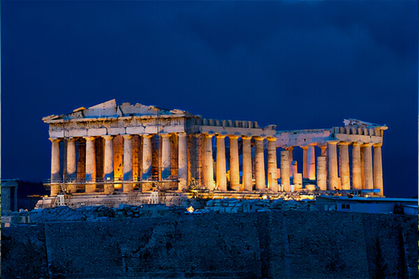
There were five towers and four gates. The acropolis to the north was fortified with a counter wall and towers around the start of the fourth century BC.
The so-called Tower of Pollux, built in the sixteenth century to dissuade Barbary pirates, stands at the entrance to the Acropolis.
The Hippodamian urban layout dates from the fourth century BC and is divided into quarters by two main avenues that intersect at right angles. Other smaller roads intersect them every 32 meters. The ruins of multiple Doric temples may be seen on the Acropolis’ top.
Manuzza Hill
The city’s major residential sector is atop Manuzza Hill, and the contemporary road tracks the border of a vast trapezoid-shaped region. The entire region was planned on a Hippodamian layout, slightly different from the acropolis, with elongated insulae of 190 x 32 m aligned north-south, initially encircled by a defensive wall.

There have been no systematic excavations in the region, but there have been some sondages that demonstrate that the area was occupied from the time of Selinus’ foundation and was not a later extension of the city.
This portion of the city was not repopulated after the destruction of Selinus in 409. Hermocrates’ exiles were exclusively put on the acropolis, which was better fortified. On the hill, a tufa construction, most likely a public building from the fifth century BC, was discovered in 1985. Beyond the dwellings, to the north, are two necropoleis: Manuzza and the older one at Galera-Bagliazzo.
Agora
The layout of the greatest agora of the ancient world, with an area of 33000 m2, more than double that of Rome’s Piazza del Popolo, was discovered beginning in 2020. The Agora, which dates back to the sixth century BC, was located in the heart of the city, surrounded by public buildings and residential sections. Previous investigations on the agora had discovered only one archaeological feature: an empty tomb in the center, perhaps that of the founder.
The East Hill
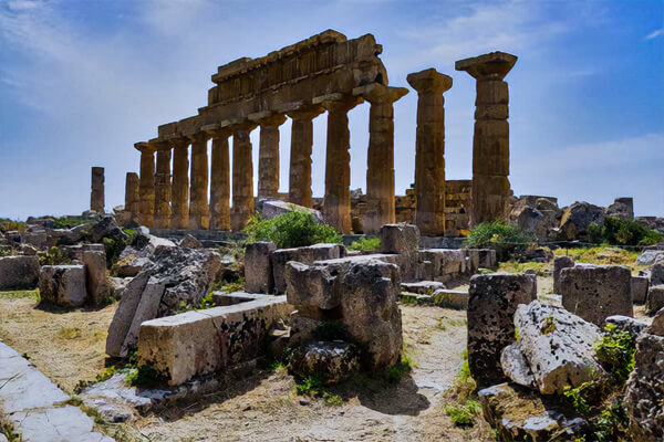
There are three temples on East Hill, which, while being in the same region and on the same north-south axis, do not appear to have belonged to a single holy compound, as Temple E is separated from Temple F by a wall. This holy complex has remarkable similarities with the western slopes of Megara’s acropolis, Selinus’ mother city, which is important for the attribution of the three temples’ cults.
The Malophoros Sanctuary on Gaggera Hill
A walkway leads from the Acropolis to West Hill, crossing the Modione River.
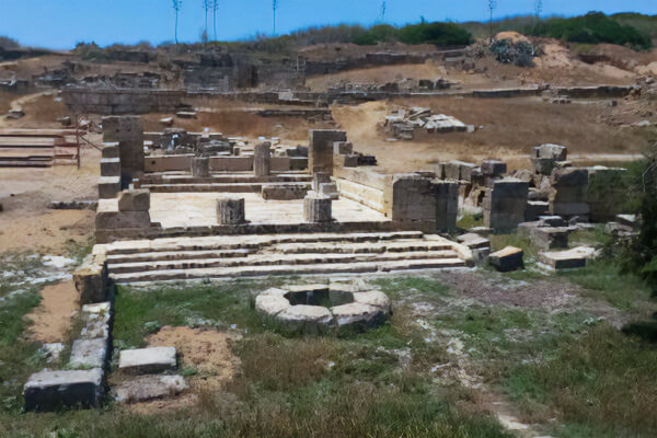
The remnants of the extremely old Selinuntine shrine to the goddess of fertility, Demeter Malophoros, were unearthed continually between 1874 and 1915 on Gaggera Hill. The complex, which is in varied levels of preservation, was erected on the slope of the hill in the sixth century BC and most likely functioned as a stop for burial processions on their way to the Manicalunga necropolis.
Initially, the area was devoid of structures and offered an open area for religious rites at the altar. It was later turned into a sanctuary with the construction of the temple and the high enclosing wall.
The Necropoleis
Around Selinus a few regions utilized as necropoleis can be recognized.
- Buffa: north of the East Slope. The location contains a triangular votive jettison with earthenware, vases, and creature remains.
- Galera Bagliazzo: northeast of Mannuzza Slope. Within the tombs burrowed into the tufa here, none particular, are grave products of different styles. In 1882 the statue called the Ephebe of Selinus was brought to light here; today it is within the Civic historical center of Castelvetrano.
- Pipio Bresciana and Manicalunga Timpone Nero: west of Gaggera Slope, the foremost extensive of Selinus’ necropoleis. Given its removal from the city middle, it isn’t clear whether it was the necropolis of the city or a rural range. As well as proof of inhumations, there are amphorae and pithoi which affirm the hone of incineration. The sarcophagi are in earthenware or tufa. There are too secured rooms.
Cave di Cusa
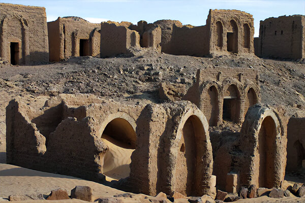
Thirteen kilometers from Selinus, the limestone banks that makeup Cave di Cusa are close to Campobello di Mazara. They were the quarries where the stone for the material for the structures of Selinus came. The most eminent component of the quarries is the unexpected interference of tasks brought about by the assault on the city in 409 BC.
The abrupt flight of the quarrymen, stonemasons, and different specialists implies that today it is conceivable to recreate, however, to see every one of the different phases of the quarrying system from the primary profound roundabout slices to the completed drums ready to be moved.
Capitals and square incisions for quarrying square blocks, in addition to the column drums, are all intended for Selinus’ temples. Some of the extracted drums were found ready for transport, while others were left behind on the road on their way to Selinus. A few enormous sections, most certainly planned for Sanctuary G, are found in the space west of Cavern di Cusa, likewise in the state in which they were initially deserted.
General Gallery Archaeological Park of Selinunte
- The Acropolis as seen from the east
- Temple E
- Temple E front
- Temple E back
- Temple C
- Aerial photo of Temple C
- Sanctuary of Demeter Malophoros
- Panorama of the ruined Temple G
History of the Archaeological Park of Selinunte
Brief of SelinunteThe colonists of Megara Hyblea, led by the ecstasy Pammilo, set out to find new markets in western Sicily, where they discovered the colony of Selinunte, a prosperous emporium. The name might be derived from “Selinon,” which alludes to the leaves of “patio,” a wild parsley that grows abundantly along the banks and valley of the Medicine River.
Two centuries of prosperity and growth
Selinunte expands, establishing itself as Apoikia and forging political and commercial ties with the Carthaginians and Greeks, constructing the Acropolis and the Sanctuary of Malophoros, and founding the sub-colony of Eraclea Minoa. It marks the beginning of one of the most prosperous Greek colonies.
The despute eith segesta
Selinunte’s expansionist desires start to threaten Segesta’s land. After numerous conflicts that ended without severe effects, it came down to a clash between two powerful alliances: Segesta, backed by Carthage and Athens, and Selinunte, backed by Syracuse, Agrigento, and Gela.

The defeat of Selinunte and The decisive battle
The fight denotes the unequivocal triumph of the Carthaginian Hannibal Magone, on account of the nonappearance of the helper troops from Agrigento and Syracuse. Hannibal smashes and loots Selinunte, saving just ladies and youngsters. As a result, one of the most glorious Greek colonies in the West has come to an end.
The treaty of peace between Carthage and Syracuse
Selinunte endeavors a recovery, depending on the union with Syracuse still on. The dictator Dionysius turns into the hero of a few endeavors to storm the projection of Lilybaeum (presently Marsala region) and drive the Carthaginians out, however, the disappointment of the tactical mission prompts a nonaggression treaty, and Selinunte wound up in the possession of Carthage.
The punic age
the Carthaginians rebuild Selinunte, but only around the Acropolis. They establish Punic elements, spread new cults, and transform the former city center of Manuzza into a necropolis.
The end of Selinunte
During the Main Punic Conflict, Selinunte trusts to no end to break liberated from the burden of Carthage with the assistance of the Romans. However, the Carthaginians like to move their assets to Lilibeo, leaving Selinunte helpless before the Romans. Selinunte was at no point ever modified and occupied in the future. Accordingly, this denotes the finish of quite possibly of the most superb and significant Greek state in Sicily.
Things to Do in Selinunte Archeological Stop
- Selinunte Archeological Park Archaeology
- Selinunte Archeological Park culture & history
- Selinunte Archeological Park Architecture
- Selinunte Archeological Park Wheelchair accessible
- Selinunte Archeological Park Sightseeing on Wheels
- Selinunte Archeological Park Private tours

Selinus’s art and other discoveries
- In the adyton of Temple G, the Great Table of Selinus was discovered in 1871. It lists all of the cults that were practiced at Selinus.
- The figurative art that was found at Selinus is very important, and the Regional Archeological Museum Antonio Salinas has a lot of it. The metopes are the best representations of Selinus’ distinctive archaic artistic style.
- Cast in a strict manner with characteristics of the Greek West, the Ephebe of Selinus is a bronze statue of an ephebe offering a libation from 470 BC. It is the only large-scale bronze work from Greek Sicily that has survived, along with the Ram of Syracuse. At Castelvetrano, it is stored. The accident occurred in the Ponte Galera neighborhood of Selinunte, which is home to one of the Selinuntine necropolises.
- Despite the abundance of Proto-Corinthian, Corinthian, Rhodian, and Attic black-figure vases found in the necropoleis, Selinus did not produce any exceptional local pottery.
- The Sanctuary of the Malophoros contained some of the most valuable votive items, including terracotta statuettes, ceramics, incense busts, altars, a bass relief depicting Hades’ rape of Persephone, and Christian lamps. Some of these items are on display and kept in the Museo Archeologico di Palermo.